Europe's famous road trips, by vehicle
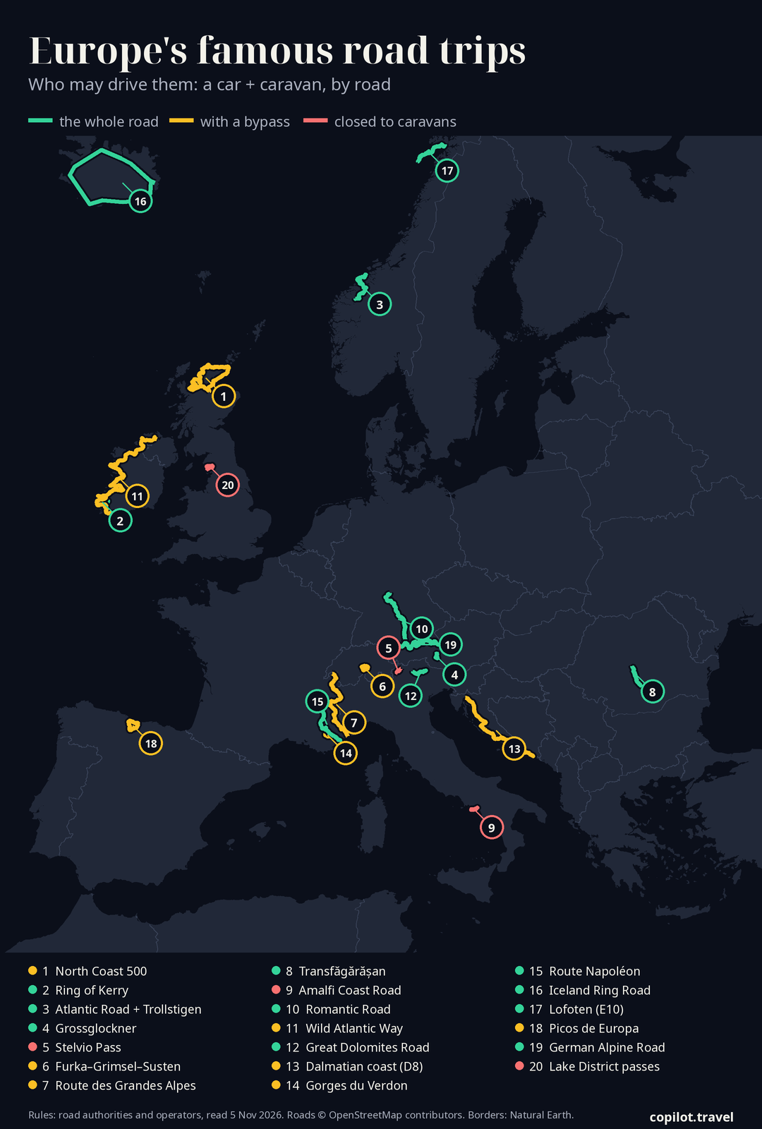
20 of the routes people dream about — what each costs in fuel, tolls and ferries for a car, a car + caravan, a motorhome and a motorcycle, and who may drive it. A car + caravan can drive 10 of them whole, 7 with a bypass, and 3 not at all.
1. North Coast 500 (NC500)
United Kingdom · a loop from Inverness · 788 km as we route it · 5–7+ days · northcoast500.com
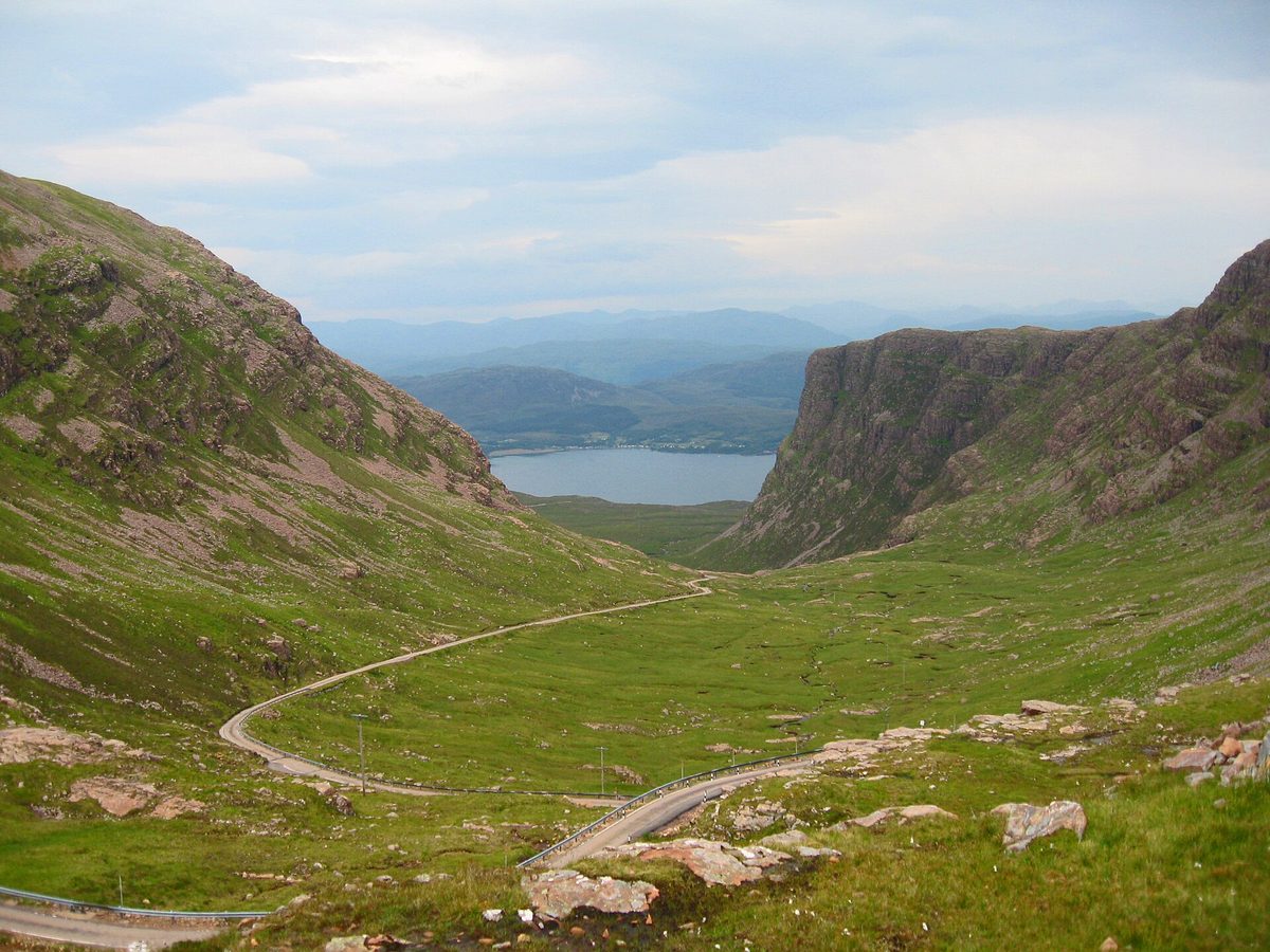

A full loop of the far north of mainland Scotland — empty single-track coast, sea lochs and the UK's steepest-climbing pass to Applecross.
Open: all year (roads open; official site notes some attractions close in winter; May–September long days)
| Vehicle | May drive it | Fuel | Tolls & ferries | Total |
|---|---|---|---|---|
| Carpetrol | Yes | €11355 l | none | €113 |
| Car + caravanpetrol, 12 m together | PartlySkip the Bealach na Bà and the B869 Drumbeg road; the official route gives a bypass for each. | €17083 l | none | €170 |
| Motorhomediesel, 7 m, 3.5 t | PartlyBigger than a VW T5 conversion (about 5 m): skip the Bealach na Bà and the B869, as the official site advises. | €22295 l | none | €222 |
| Motorcyclepetrol | Yes | €7335 l | none | €73 |
The rules, with sources (4)
- Motorhomes bigger than a standard VW T5 conversion (about 16–18 ft / ~5 m) should not drive the Bealach na Bà (take the A896/A832 low road via Shieldaig to Applecross) or the B869 Drumbeg road (take the A894/A837). northcoast500.com
- Larger motorhomes and caravans: take the alternative routes on the NC500 map, avoiding the B869 Drumbeg loop and the Bealach na Bà. northcoast500.com
- Road sign at the Lochcarron/Tornapress end of Bealach na Bà (secondary — quoted by The Scotsman): 'This road rises to a height of 2053 ft, with gradients of 1 in 5 and hairpin bends. Not advised for learner drivers, very large vehicles or caravans after first mile.' Alternative low-level route via Shieldaig–Kenmore signed. scotsman.com
- Single-track roads: if you cannot reverse your vehicle several hundred yards on a narrow single-track road you cannot safely drive them; pull into passing places to let faster traffic by; never park in passing places; do not drive in convoy (keep at least one passing place apart). northcoast500.com
Riders: ride.co.uk · mcncompare.com put it on their lists.
2. Ring of Kerry (Mórchuaird Chiarraí)
Ireland · a loop from Killarney · 174 km as we route it · 1–2 days · discoverkerry.com
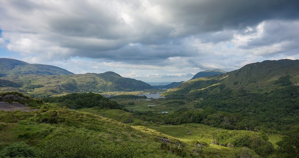

Ireland's best-known day drive: a loop round the Iveragh peninsula with sea views to the Skelligs and the lakes of Killarney at the end.
Open: all year
| Vehicle | May drive it | Fuel | Tolls & ferries | Total |
|---|---|---|---|---|
| Carpetrol | Yes | €2412 l | none | €24 |
| Car + caravanpetrol, 12 m together | Yes | €3618 l | none | €36 |
| Motorhomediesel, 7 m, 3.5 t | Yes | €4521 l | none | €45 |
| Motorcyclepetrol | Yes | €158 l | none | €15 |
The rules, with sources (2)
- Tour coaches run the ring counter-clockwise (Killarney→Killorglin→Cahersiveen→Kenmare) so they don't meet on narrow sections — stated in Kerry County Council's N70 Waterville–Ballybrack planning report (Dec 2025). Practical advice for caravans and motorhomes: go the same way as the coaches (anti-clockwise) — this advice itself is secondary (motorhome press/forums). consult.kerrycoco.ie
- Side passes off the ring — Ballaghbeama Gap and the Gap of Dunloe — are narrow single-track; Gap of Dunloe is jaunting-car/walking territory and not for caravans or motorhomes (secondary; no official page read). en.wikipedia.org
3. Atlantic Road, Trollstigen and Geiranger (Atlanterhavsvegen – Trollstigen – Geiranger)
Norway · Kristiansund to Hellesylt · 270 km as we route it · 2–4 days · nasjonaleturistveger.no
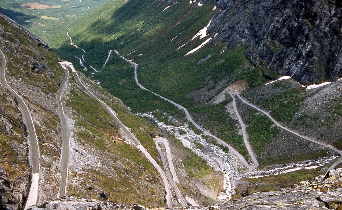

Two of Norway's signature drives in one go: bridges hopping skerries over open sea, then the eleven hairpins of Trollstigen and the descent into the Geirangerfjord.
Open: Atlantic Road: all year. Trollstigen (Fv63): winter-closed; official past closures 5 Oct–7 Dec, openings 29 Apr–12 Jun; 2026 opened 27 Apr (Møre og Romsdal county road administration). Langvatnet–Geiranger: past closures 18 Nov–9 Jan, openings 27 Apr–17 Jun. Geiranger–Hellesylt ferry: summer only (Fjord1 'suspended until further notice' as read 5 Nov 2026).
| Vehicle | May drive it | Fuel | Tolls & ferries | Total |
|---|---|---|---|---|
| Carpetrol | Yes | €3919 l | Geiranger–Hellesylt ferry: €76Linge–Eidsdal ferry (up to 6 m): €8 | €122 |
| Car + caravanpetrol, 12 m together | YesTrollstigen is narrow: advice to plan well and expect to meet traffic, no ban. | €5828 l | Geiranger–Hellesylt ferry: €187Linge–Eidsdal ferry (10–12.5 m): €29 | €274 |
| Motorhomediesel, 7 m, 3.5 t | YesTrollstigen is narrow: advice, no ban. | €6332 l | Geiranger–Hellesylt ferry: €145Linge–Eidsdal ferry (6–8 m): €17 | €224 |
| Motorcyclepetrol | Yes | €2512 l | Geiranger–Hellesylt ferry: €61Linge–Eidsdal ferry (motorcycle): €3 | €89 |
The rules, with sources (5)
- Trollstigen section: buses limited to max 13.3 m length (the often-quoted 12.4 m is from secondary sites only) nasjonaleturistveger.no
- Trollstigen and Langvatnet–Geiranger are closed in winter; after opening may close at night and in bad weather nasjonaleturistveger.no
- Autumn 2026: Fv63 Trollstigfoten–Trollstigplatået closed Mon–Fri 07:00–18:00 from Mon 28 Sep for about four weeks (maintenance); open evenings and weekends (regional tourism body Fjord Norway, citing the road authority) fjordnorway.com
- Trollstigen is narrow and winding – large campervans or caravans should plan well and be ready to meet oncoming traffic (advice, not a ban) fjordnorway.com
- No emptying of motorhome/caravan toilets in the scenic-route toilets; use dump stations nasjonaleturistveger.no
Riders: motovault.app · adventurebikerider.com put it on their lists.
4. Grossglockner High Alpine Road (Großglockner-Hochalpenstraße)
Austria · Bruck an der Großglocknerstraße to Heiligenblut · 77 km as we route it · 1 day · grossglockner.at
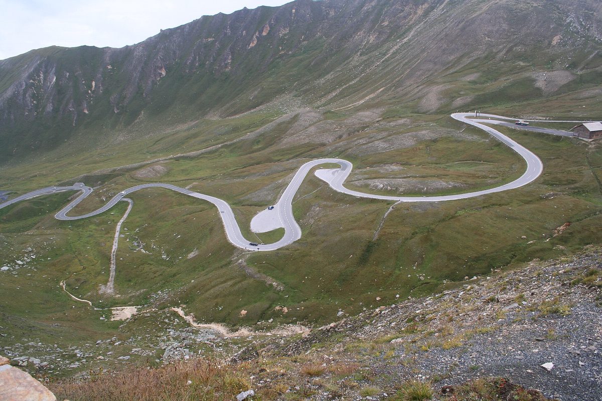

Austria's showpiece mountain road: hairpins climbing to the 2,504 m Hochtor with the Grossglockner and the Pasterze glacier in full view.
Open: Grossglockner: start of May – start of November (official); 2026 closed after 1 Nov 2026, winter closure until early May 2027. Daily hours: to 31 May 06:00–20:00, 1 Jun–31 Aug 05:30–21:00, from 1 Sep 06:00–19:30 (last entry 45 min before)
| Vehicle | May drive it | Fuel | Tolls & ferries | Total |
|---|---|---|---|---|
| Carpetrol | Yes | €105 l | Grossglockner High Alpine Road: €47 | €57 |
| Car + caravanpetrol, 12 m together | YesCar rate when the towing car is up to 3.5 t. | €148 l | Grossglockner High Alpine Road: €47 | €61 |
| Motorhomediesel, 7 m, 3.5 t | YesUp to 3.5 t pays the car rate; heavier pays the truck rate. The Edelweißspitze spur is closed over 3.5 t. | €209 l | Grossglockner High Alpine Road: €47 | €67 |
| Motorcyclepetrol | Yes | €63 l | Grossglockner High Alpine Road: €37 | €43 |
The road itself is not a motorway. Coming by motorway: Austria's motorway vignette (car €9.6, motorcycle €3.8, the shortest one sold).
The rules, with sources (4)
- Night-time driving ban outside opening hours (official). grossglockner.at
- Edelweißspitze spur closed to vehicles over 3.5 t; operator says motorhome trips up the spur are not advisable. grossglockner.at
- Caravans are allowed: a car + caravan with tow vehicle up to 3,500 kg GVW pays the car rate; motorhomes/caravans 3.5–7.5 t pay 'Truck 1', over 7.5 t 'Truck 2'. grossglockner.at
- No overnight stays in car/camper and no camping anywhere along the road (Hohe Tauern National Park). grossglockner.at
Riders: grossglockner.at · bestdrivingroads.com put it on their lists.
5. Stelvio Pass (Passo dello Stelvio / Stilfser Joch)
Italy · Prato allo Stelvio / Prad to Bormio · 46 km as we route it · 1 day · ktips.bormio.eu
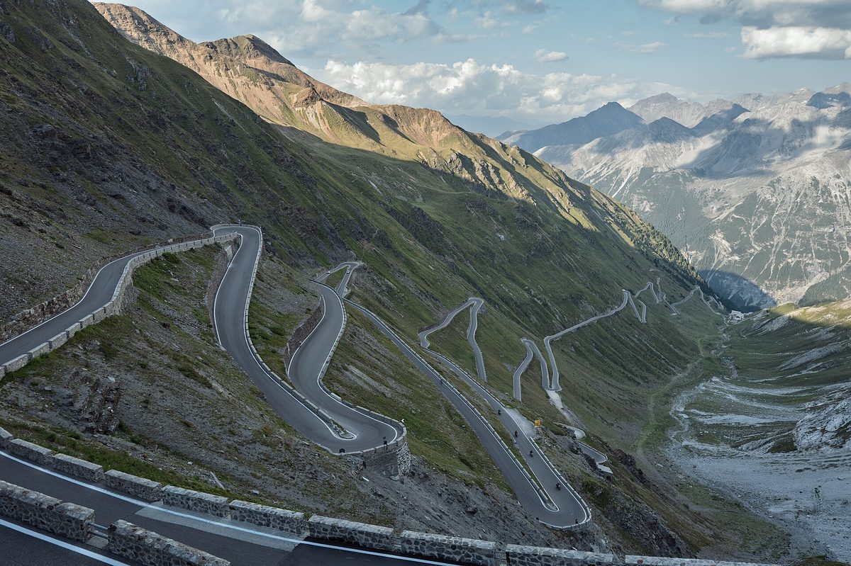

The famous stacked hairpins (48 on the Prato side, 41 from Bormio) up to 2,758 m, Italy's highest paved pass.
Open: Roughly late May – early November, weather-dependent (Bormio tourism). 2026: all sides reopened 22 May 2026 10:00 (ANAS, reported by sondriotoday.it); South Tyrol side Passhöhe–Drei Brunnen in WINTERSPERRE as read on the Bolzano traffic centre 2026-11-05
| Vehicle | May drive it | Fuel | Tolls & ferries | Total |
|---|---|---|---|---|
| Carpetrol | Yes | €63 l | none | €6 |
| Car + caravanpetrol, 12 m together | NoTrailers are banned (Austrian motoring club's pass list), and both sides have length limits. Go round via Reschen or the Ofen Pass. | — | — | not allowed |
| Motorhomediesel, 7 m, 3.5 t | PartlyBormio side: no vehicles over 3.3 m high or 10 m long; South Tyrol side: none over 10.5 m. | €126 l | none | €12 |
| Motorcyclepetrol | Yes | €42 l | none | €4 |
The rules, with sources (4)
- South Tyrol (Prato/Trafoi) side: no vehicles longer than 10.50 m. ktips.bormio.eu
- Lombardy (Bormio) side: no vehicles higher than 3.30 m or longer than 10 m — matters for tall motorhomes. ktips.bormio.eu
- Absolute trailer ban (Anhängerverbot) and no buses — secondary: ÖAMTC pass database (search snippet; page did not render) and outdooractive; not seen on an authority page today. oeamtc.at
- Winter closure: section pass summit – Drei Brunnen/Trafoi (km 124.300–137.500) closed for winter (status today). provincia.bz.it
Riders: motorprosa.com · calimoto.com put it on their lists.
6. Furka–Grimsel–Susten loop (Swiss three-pass loop)
Switzerland · a loop from Andermatt · 120 km as we route it · 1 day · myswitzerland.com
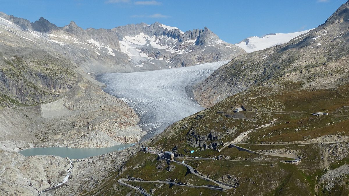

Three high passes in one day: the Furka's Rhône Glacier views (Goldfinger's chase road), Grimsel's dam lakes and the Susten's glacier-lined descent.
Open: Roughly late May/June – late October. 2026: Furka 28 May – 28 Oct (closed by Canton Uri 28 Oct 10:00); Grimsel 28 May – 27 Oct, briefly reopened, final winter closure Fri 6 Nov 2026 16:00; Susten 6 Jun – 27/28 Oct
| Vehicle | May drive it | Fuel | Tolls & ferries | Total |
|---|---|---|---|---|
| Carpetrol | Yes | €168 l | none | €16 |
| Car + caravanpetrol, 12 m together | PartlyThe Furka bans trailers (pass guides; not on a canton page). Grimsel and Susten state no trailer ban; the Furka car train is the bypass. | €2313 l | none | €23 |
| Motorhomediesel, 7 m, 3.5 t | Yes | €2814 l | none | €28 |
| Motorcyclepetrol | Yes | €105 l | none | €10 |
The road itself is not a motorway. Coming by motorway: Switzerland's motorway vignette (car €43, motorcycle €43, car + caravan €86, the shortest one sold).
The rules, with sources (4)
- Canton Uri closed Furka (from Realp) and Susten (from Sustenbrüggli) for winter on 28 Oct 2026, in agreement with Valais and Bern. ur.ch
- Furka: general trailer ban, also for caravans; max 18 t Realp – summit (secondary: IG Alpenpässe alpen-paesse.ch and TCS pass portal, not a canton page). alpen-paesse.ch
- Grimsel: night closure 18:00–08:00 from Räterichsboden (status late season 2026); max 32 t Gletsch–Brig section (secondary: alpen-paesse.ch). alpen-paesse.ch
- Susten: max 32 t Wassen–Innertkirchen; no trailer ban stated (secondary: alpen-paesse.ch). alpen-paesse.ch
Riders: myswitzerland.com · visordown.com put it on their lists.
7. Route des Grandes Alpes
France · Thonon-les-Bains to Menton · 670 km as we route it · 5–7 days · menton-riviera-merveilles.co.uk
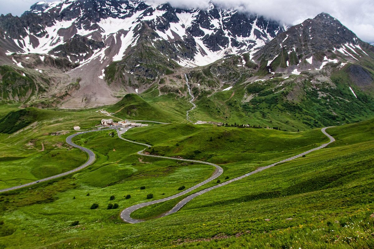

Lake Geneva to the Mediterranean over the highest passes of the French Alps — Iseran, Galibier, Izoard, Bonette — in one north–south line.
Open: Through-route only when the high cols are open: roughly June – October (Menton tourist office: 'some mountain passes are only open between June and October'; Menton – Col de Turini open all year)
| Vehicle | May drive it | Fuel | Tolls & ferries | Total |
|---|---|---|---|---|
| Carpetrol | Yes | €10247 l | none | €102 |
| Car + caravanpetrol, 12 m together | PartlyNo ban on any col, but the high narrow ones (Iseran, Galibier, Bonette, Turini) are a poor fit for towing; valley roads go round each. | €15370 l | none | €153 |
| Motorhomediesel, 7 m, 3.5 t | Yes | €18980 l | none | €189 |
| Motorcyclepetrol | Yes | €6630 l | none | €66 |
The rules, with sources (1)
- High cols (Iseran, Galibier, Bonette, Izoard etc.) close in winter; only ~June–October is the full route driveable (official tourism, general wording; per-col departmental decrees not read). menton-riviera-merveilles.co.uk
Riders: menton-riviera-merveilles.co.uk · en.wikipedia.org put it on their lists.
8. Transfăgărășan (DN7C)
Romania · Bascov to Cârțișoara · 157 km as we route it · 1–2 days · cnadnr.ro
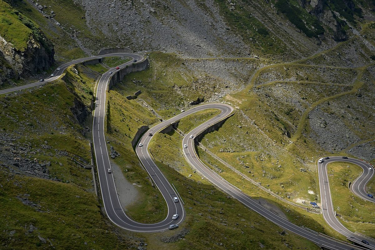

A 1970s military road that loops in tight hairpins over the Făgăraș ridge to a glacial lake at 2,000 m.
Open: Mountain section (km 104–130.8, Piscul Negru – Bâlea Cascadă) usually open early June – about 20 Oct; legal closure window 20 Oct – 30 Jun under the mountain-roads rule, actual dates set each year by CNAIR. Opened 7 Jun 2024, 6 Jun 2025, 12 Jun 2026; closed 20 Oct 2025 (secondary summaries of CNAIR releases).
| Vehicle | May drive it | Fuel | Tolls & ferries | Total |
|---|---|---|---|---|
| Carpetrol | Yes | €2111 l | Romanian e-vignette (rovinieta): €4 | €25 |
| Car + caravanpetrol, 12 m together | YesNo caravan or weight ban announced; tight hairpins near the top. | €3116 l | Romanian e-vignette (rovinieta): €4 (the towing car's; the tariff lists no trailer category) | €35 |
| Motorhomediesel, 7 m, 3.5 t | Yes | €3819 l | Romanian e-vignette (rovinieta): €4 | €42 |
| Motorcyclepetrol | Yes | €137 l | Romanian e-vignette (rovinieta): €0 (the tariff has no motorcycle category) | €13 |
The rules, with sources (2)
- Mountain section Piscul Negru – Bâlea Cascadă open only 07:00–21:00 (night closure) — announced by the CNAIR director for the 2026 opening (reported by Digi24; secondary). digi24.ro
- Closes outside the season (20 Oct – 30 Jun window, AND 615-2020) and at short notice for weather; no tonnage or caravan ban announced by CNAIR in 2024–2026 releases (secondary summary). colegu.eu
Riders: moto-guide.com · 24mx.com put it on their lists.
9. Amalfi Coast Road (Strada Statale 163 Amalfitana)
Italy · Salerno to Sorrento · 78 km as we route it · 1–2 days · stradeanas.it
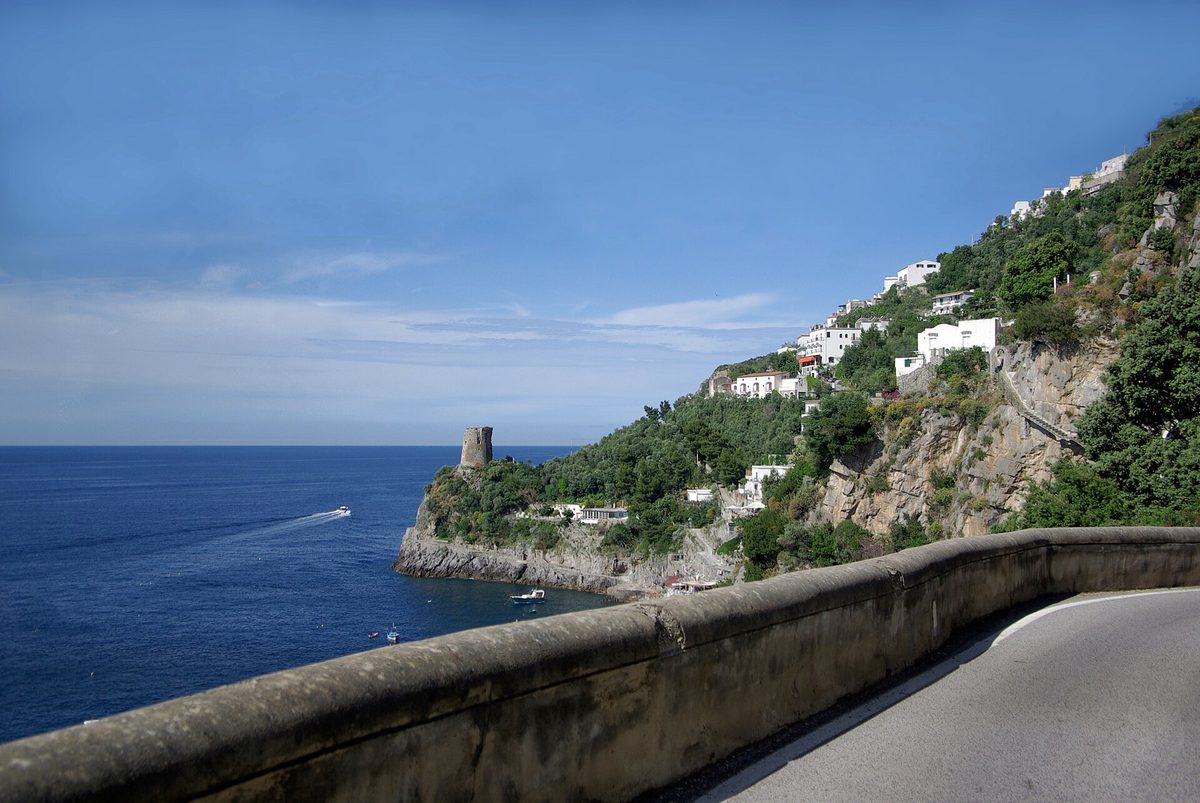

A ledge road cut into sea cliffs, linking pastel villages above the Tyrrhenian Sea, bend after bend.
Open: all year; summer and holiday weekends carry the alternating-plate rule (see restrictions)
| Vehicle | May drive it | Fuel | Tolls & ferries | Total |
|---|---|---|---|---|
| Carpetrol | YesOn set 2026 dates, 10:00–18:00: odd/even number plates only (ANAS 340/2019). | €115 l | none | €11 |
| Car + caravanpetrol, 12 m together | NoCampers and caravans are banned 06:30–24:00 between Positano and Vietri (ANAS ordinance 337/2019, wording via the local press). | — | — | not allowed |
| Motorhomediesel, 7 m, 3.5 t | NoBanned 06:30–24:00 between Positano and Vietri (ANAS 337/2019, wording via the local press). | — | — | not allowed |
| Motorcyclepetrol | YesTwo-wheelers are exempt from the odd/even plate days. | €74 l | none | €7 |
The rules, with sources (5)
- Alternating number plates (targhe alterne) for non-resident cars on SS163 between Vietri sul Mare and Positano, 10:00–18:00 only: on odd dates plates ending in an odd digit may not drive, on even dates even ones. 2026 calendar: 30 Mar–6 Apr and 25 Apr–2 May daily; June–July Sat/Sun/holidays; August–September daily; October Sat/Sun/holidays. Exempt: residents of the 14 coast municipalities, disability badges, taxis/NCC, hotel guests on check-in/check-out day. Basis ANAS ordinance 340/2019 plus municipal ordinances (read on the Praiano municipality and the coast's tourist district pages). comune.praiano.sa.it
- Two-wheelers are NOT affected by the alternating-plate rule ('I mezzi a due ruote non sono interessati'). comune.praiano.sa.it
- Campers and caravans of any size banned on SS163 from 06:30 to 24:00 in both directions (ANAS ordinance 337/2019, km 10+195 Positano – km 49+600 Vietri). Wording quoted by local paper Il Vescovado (secondary); the ANAS PDF itself returned an error when read. ilvescovado.it
- Same ANAS 337/2019 ban as motorhomes: no car + caravan 06:30–24:00 (secondary wording, see motorhome entry). stradeanas.it
- Tourist buses over 4 m high or 10.36 m long banned on SS163 (ANAS ordinance 29/2013 as published by Comune di Amalfi; older ordinance, the 2019 ones superseded/combined it — check). comune.amalfi.sa.it
Riders: moto-guide.com · theguardian.com put it on their lists.
10. Romantic Road (Romantische Straße)
Germany · Würzburg to Füssen · 383 km as we route it (officially 460 km — fuel priced on that) · 3–5 days · romantischestrasse.de
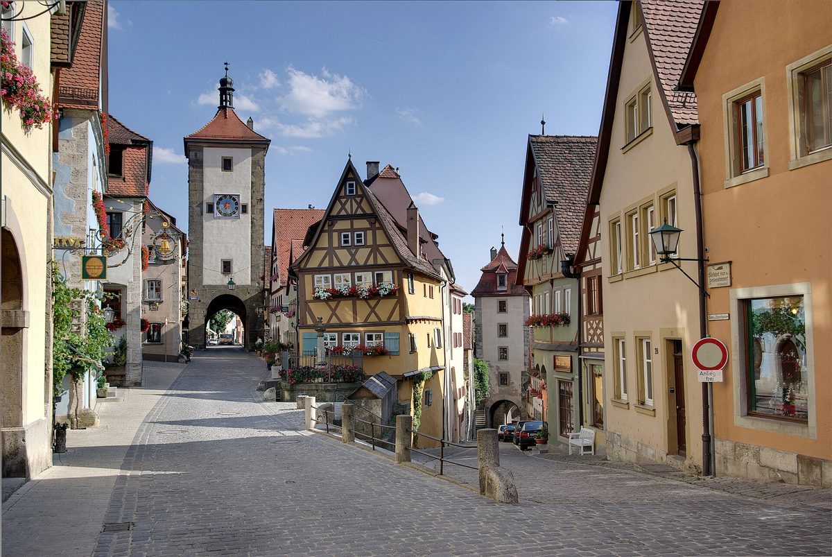

A chain of walled medieval towns — Rothenburg, Dinkelsbühl, Nördlingen — from the Main valley to Neuschwanstein at the foot of the Alps.
Open: all year
| Vehicle | May drive it | Fuel | Tolls & ferries | Total |
|---|---|---|---|---|
| Carpetrol | Yes | €7032 l | none | €70 |
| Car + caravanpetrol, 12 m together | Yes | €10448 l | none | €104 |
| Motorhomediesel, 7 m, 3.5 t | Yes | €12755 l | none | €127 |
| Motorcyclepetrol | Yes | €4420 l | none | €44 |
11. Wild Atlantic Way (Slí an Atlantaigh Fhiáin)
Ireland · Kinsale to Muff · 1,168 km as we route it (officially 2,500 km — fuel priced on that) · 14–21 (secondary; official site says do it in sections or all at once) days · ireland.com
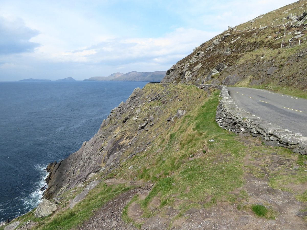

The whole Atlantic edge of Ireland in one signed drive — cliffs, peninsulas and surf beaches from West Cork to Inishowen.
Open: all year
| Vehicle | May drive it | Fuel | Tolls & ferries | Total |
|---|---|---|---|---|
| Carpetrol | Yes | €345176 l | none | €345 |
| Car + caravanpetrol, 12 m together | PartlyConor Pass: nothing over 2 t or 1.8 m wide beyond the summit car park (Kerry County Council); Healy Pass is single-lane. The main route goes round both. | €518263 l | none | €518 |
| Motorhomediesel, 7 m, 3.5 t | PartlyConor Pass: nothing over 2 t or 1.8 m wide beyond the summit (Kerry County Council); take the main road round. | €642300 l | none | €642 |
| Motorcyclepetrol | Yes | €223113 l | none | €223 |
The rules, with sources (3)
- Conor Pass (R560, Dingle–Brandon Bay side road of the route): Kerry County Council limits — vehicles may not exceed 2 tonnes or 1.8 m width beyond the summit car park (north-east side); so no coaches, caravans, camper vans or trucks. Secondary (Radio Kerry, 15 Jul 2025, reporting the council's current restriction; Dingle Peninsula Tourism Alliance also states 2 t and 7.2 m length). Bypass: N86 via Annascaul. radiokerry.ie
- Conor Pass: 'Vehicles greater than 2 tonnes in weight are not permitted to travel north-east of the car park at the summit' (local tourism co-operative site, not the council — secondary). dingle-peninsula.ie
- Healy Pass (R574, Beara): narrow single-lane mountain road, unsuitable for caravans/large campervans — secondary only; no official restriction found. Main Beara route via Castletownbere does not need it. trips.ie
Riders: bennetts.co.uk · waw4bikers.com put it on their lists.
12. Great Dolomites Road (Grande Strada delle Dolomiti, SS241/SS48)
Italy · Bolzano to Cortina d'Ampezzo · 113 km as we route it · 1–2 days ·
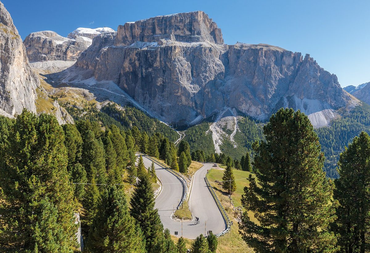

The historic road threading the Dolomites' pale rock towers from Bolzano over the Karerpass, Pordoi and Falzarego to Cortina.
Open: All year as a road (Karerpass, Pordoi, Falzarego are kept open in winter; snow chains/winter tyres) — Bolzano traffic centre lists no seasonal closure for these three
| Vehicle | May drive it | Fuel | Tolls & ferries | Total |
|---|---|---|---|---|
| Carpetrol | Yes | €168 l | none | €16 |
| Car + caravanpetrol, 12 m together | YesAllowed on the route; the Sella Pass next to it bans all trailers. | €2412 l | none | €24 |
| Motorhomediesel, 7 m, 3.5 t | YesPordoi–Arabba: nothing over 12 m from 15 Nov to 30 Apr. | €3014 l | none | €30 |
| Motorcyclepetrol | Yes | €105 l | none | €10 |
The rules, with sources (7)
- Pordoi – Arabba (km 76.280–84.900): no vehicles over 12 m, every year 15 Nov – 30 Apr. provincia.bz.it
- Falzarego (Belluno side, Cernadoi – pass): ban only for semi-trailers over 3.20 m high and 13 m long. provincia.bz.it
- Karerpass / Eggental: no restrictions (status today). provincia.bz.it
- Not on this route but next to it: Sella Pass (Plan – pass, km 22.370–30.950) bans ALL vehicles with trailers; Gardena Pass bans articulated lorries and lorries with trailers. provincia.bz.it
- Sellaronda Bike Day: Pordoi (plus Sella, Gardena, Campolongo) closed to motor traffic 6 Jun 2026 and 12 Sep 2026, 09:00–16:00. sellarondabikeday.com
- Dolomites Bike Day: Falzarego, Valparola, Campolongo closed to traffic Sat 20 Jun 2026, 09:00–15:00. dolomitisuperski.com
- No traffic caps or bookings on Dolomite passes in 2026 — Province of Bolzano said no physical limits in 2026; Passo Gardena ZTL digital tests from Sep 2026, possible measures summer 2027 (secondary: moto.it reporting the Province). Province also ends motorsport events in protected high areas. Roadside checks on modified/noisy vehicles, fines up to €1,731 (secondary: ildolomiti.it). moto.it
Riders: calimoto.com · trueriders.it put it on their lists.
13. Adriatic coast road (Jadranska magistrala, D8): Rijeka – Dubrovnik
Croatia · Rijeka to Dubrovnik · 627 km as we route it · 5–8 days · m.hak.hr
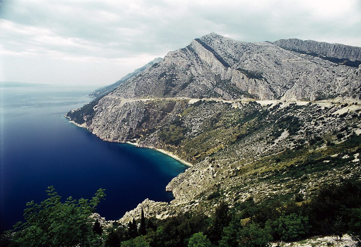

Europe's great island-and-limestone coastline, driven its whole length on one old shore road above clear water.
Open: all year; bura (bora) wind closures mostly autumn–spring
| Vehicle | May drive it | Fuel | Tolls & ferries | Total |
|---|---|---|---|---|
| Carpetrol | Yes | €7944 l | none | €79 |
| Car + caravanpetrol, 12 m together | PartlyIn bura (strong wind) sections of the D8 close to cars with caravans or trailers (HAK); wait it out or take the motorway inland. | €11866 l | none | €118 |
| Motorhomediesel, 7 m, 3.5 t | Yes | €15175 l | none | €151 |
| Motorcyclepetrol | PartlyIn bura, sections close to motorcycles too (same wind group as caravans, HAK). | €5128 l | none | €51 |
The rules, with sources (3)
- In bura the D8 is closed in sections (typically Bakar/Novi Vinodolski – Senj – Karlobag – Sveta Marija Magdalena) to 'I. skupina vozila': double-decker buses, vehicles with caravans/trailers and motorcycles; in stronger wind also vans and high-sided vehicles (Karlobag – Sv. M. Magdalena). Announced live by HAK (Croatian Auto Club, the national road-info service). m.hak.hr
- Motorcycles are in the same wind-ban group I as caravans on the D8 and on A7/Krk bridge in bura (HAK). m.hak.hr
- Neum corridor (Bosnia and Herzegovina, ~9 km) avoided since 2022 via the Pelješac Bridge and access roads (Duboka on D8 – Pelješac – Ston); route stays in Croatia/EU without border checks. hrvatske-ceste.hr
Riders: moto-guide.com put it on their lists.
14. Gorges du Verdon loop with Route des Crêtes (D23)
France · a loop from Moustiers-Sainte-Marie · 144 km as we route it · 1–2 days · en.tourisme-alpes-haute-provence.com
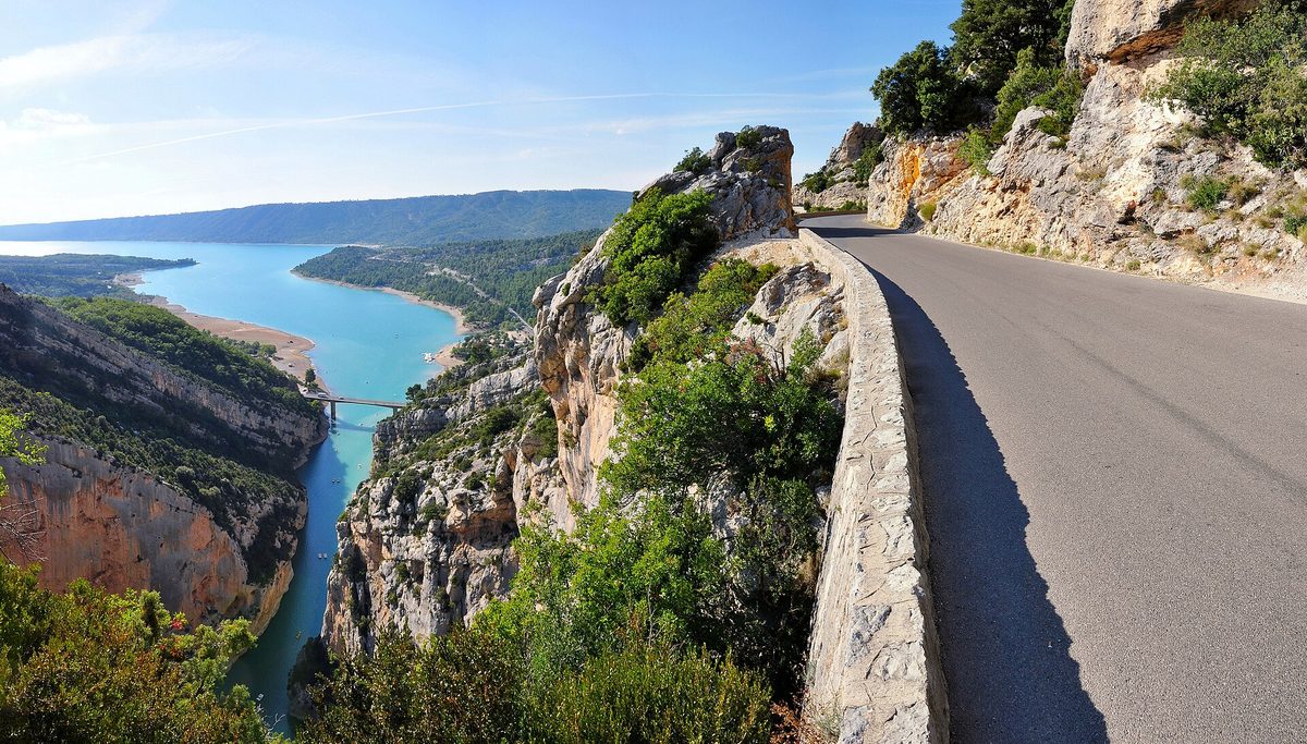

Rim roads along Europe's deepest river canyon, with turquoise water 700 m below the viewpoints.
Open: Route des Crêtes central section (Pas de Baou – Chalet de la Maline) open 28 Apr – 21 Nov 2026, closed from the 4th Friday of November to the 4th Friday of March (official); rest of the loop all year
| Vehicle | May drive it | Fuel | Tolls & ferries | Total |
|---|---|---|---|---|
| Carpetrol | Yes | €2210 l | none | €22 |
| Car + caravanpetrol, 12 m together | PartlyLeave the caravan off the Route des Crêtes (D23 loop): advised against over 7 m long or 2 m wide (local source, no official order seen). | €3315 l | none | €33 |
| Motorhomediesel, 7 m, 3.5 t | YesD23 overhangs: 3.6 m at the sides, 4.3 m in the middle; one-way, drive it clockwise from La Palud. | €4117 l | none | €41 |
| Motorcyclepetrol | Yes | €146 l | none | €14 |
The rules, with sources (3)
- D23 Route des Crêtes is one-way between Jas d'Aire and La Maline: drive it clockwise from La Palud. en.tourisme-alpes-haute-provence.com
- Tunnel/overhang height limits on D23: 3.6 m at the sides, 4.3 m in the centre; buses can pass but the road is vertiginous. en.tourisme-alpes-haute-provence.com
- Route des Crêtes forbidden or strongly advised against for vehicles over 2 m wide and 7 m long (secondary — a local guesthouse page; no official order seen). lacalade-provence.fr
Riders: adac.de · simonweir.co.uk put it on their lists.
15. Route Napoléon (Golfe-Juan – Grenoble)
France · Golfe-Juan to Grenoble · 344 km as we route it · 2–3 days · route-napoleon.com
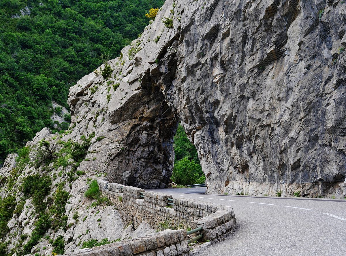

Napoleon's 1815 march from the Mediterranean to the Alps, now a flowing road over limestone plateaux and cols.
Open: all year (Col Bayard north of Gap and Col de Luens/Valferrière can see winter snow)
| Vehicle | May drive it | Fuel | Tolls & ferries | Total |
|---|---|---|---|---|
| Carpetrol | Yes | €5324 l | none | €53 |
| Car + caravanpetrol, 12 m together | Yes | €7936 l | none | €79 |
| Motorhomediesel, 7 m, 3.5 t | Yes | €9741 l | none | €97 |
| Motorcyclepetrol | Yes | €3415 l | none | €34 |
Riders: moto-guide.com · adventurebikerider.com put it on their lists.
16. Iceland Ring Road (Route 1 / Hringvegur)
IS · a loop from Seyðisfjörður (ferry) · about 1,322 km (officially 1,322 km — fuel priced on that) · 7–12 (plus ~2 days 16 h each way on the ferry) days · smyrilline.com
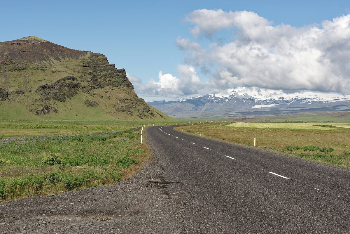

One paved loop around a whole volcanic island: glaciers, black-sand beaches, waterfalls and lava fields, reached by a multi-day sea crossing with your own vehicle.
Open: Route 1 open all year but winter storms close sections; ferry Hirtshals–Seyðisfjörður sails weekly April – mid-November (Smyril Line), two weekly Denmark–Faroes departures in summer, one continuing to Iceland
| Vehicle | May drive it | Fuel | Tolls & ferries | Total |
|---|---|---|---|---|
| Carpetrol | YesFrom mainland Europe only on the Norröna ferry from Hirtshals (about 2 days 16 h), booked separately. | not priced | not priced | — |
| Car + caravanpetrol, 12 m together | YesNorröna ferry: no gas in use and no battery charging on board. | not priced | not priced | — |
| Motorhomediesel, 7 m, 3.5 t | YesNorröna ferry: no gas in use and no battery charging on board. | not priced | not priced | — |
| Motorcyclepetrol | Yes | not priced | not priced | — |
Not priced: IS is outside our weekly pump prices, and the ferry there is priced only at booking.
The rules, with sources (5)
- Mainland Europe → Iceland only by Smyril Line's Norröna, Hirtshals (DK) – Tórshavn (FO) – Seyðisfjörður (IS), about 2 days 16 hours smyrilline.com
- On board: no charging of batteries in campers, motorhomes and caravans; gas appliances must not be used; car deck closed at sea smyrilline.com
- Oversized vehicles: contact Smyril Line for availability/price; secondary (icelandferries.com): online booking covers cars to ~1.9 m high/5 m long and motorhomes to ~7 m long/3.5 m high, trailer combinations by direct contact smyrilline.com
- F-roads (highlands) are not Route 1; usually closed mid-September until June/July and need suitable 4x4 safetravel.is
- Speed limits 90 km/h rural paved, 80 km/h gravel, 50 km/h urban unless signed safetravel.is
Riders: smyrilline.com · bikesandbays.com put it on their lists.
17. Lofoten Islands, E10 to Å (Nasjonal turistveg Lofoten)
Norway · Gullesfjordbotn (Lofast) to Å · 253 km as we route it · 3–5 days · nasjonaleturistveger.no
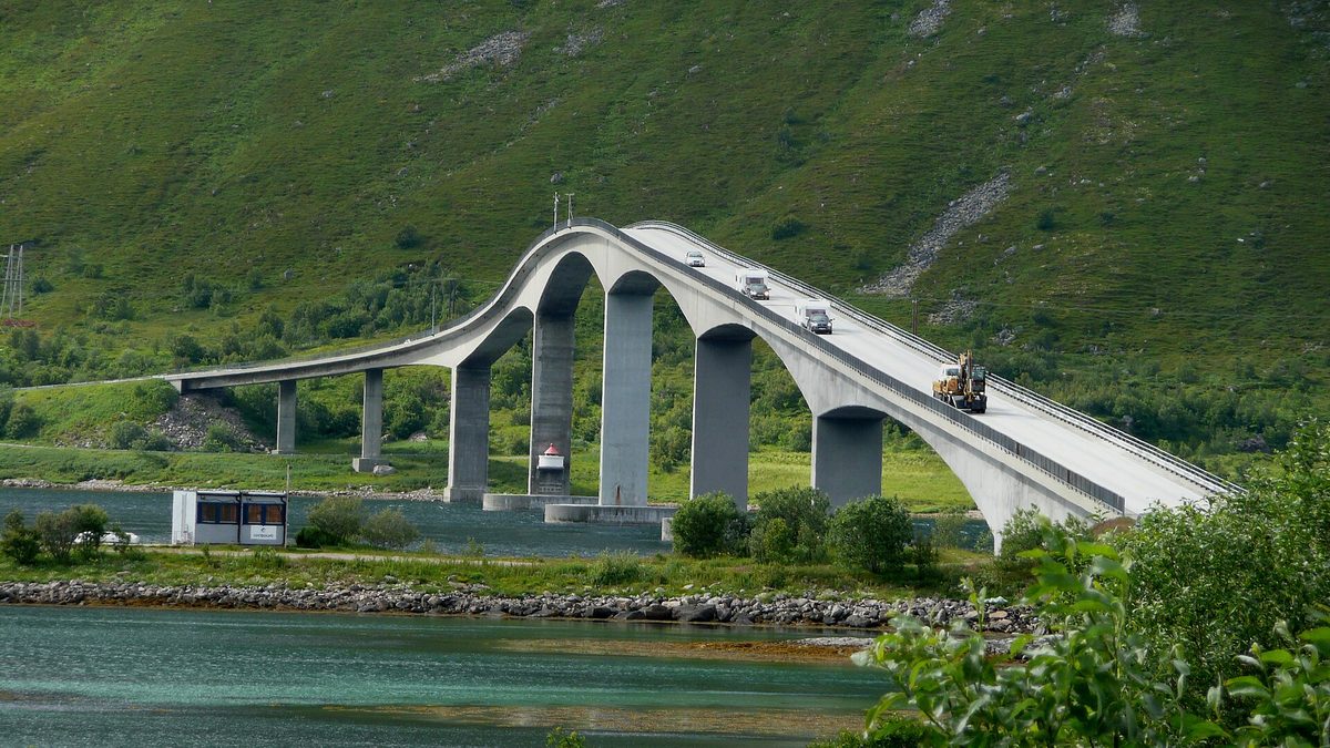

Granite peaks rising straight out of the sea, red fishing cabins and an island-hopping road of bridges and tunnels to the village at the end of the alphabet.
Open: all year (no official closure stated; winter driving conditions)
| Vehicle | May drive it | Fuel | Tolls & ferries | Total |
|---|---|---|---|---|
| Carpetrol | Yes | €3618 l | none | €36 |
| Car + caravanpetrol, 12 m together | YesNo parking 00:00–06:00 at named sites in Vågan and Værøy (Lofoten outdoor rules §6). | €5427 l | none | €54 |
| Motorhomediesel, 7 m, 3.5 t | YesNo parking 00:00–06:00 at named sites in Vågan and Værøy (Lofoten outdoor rules §6); use the dump stations. | €5930 l | none | €59 |
| Motorcyclepetrol | Yes | €2311 l | none | €23 |
The rules, with sources (3)
- Friluftsforskrift for Lofoten §6: motorhome and caravan parking banned 00:00–06:00 at named sites in Vågan (Stranda under fjellet, Kalle, Rørvika, along Lille Kongsvatn) and Værøy; tenting ban areas under §5 lovdata.no
- Respect signs banning parking/camping/overnight stays in motorhomes or caravans; keep at least 4 m from other vehicles (fire safety) visitlofoten.com
- No emptying of motorhome/caravan toilets in scenic-route toilets; dump stations at Reine, Hamnøy, Ramberg, Leknes, Lyngvær, Svolvær, Austnesfjorden, Torvdalshalsen nasjonaleturistveger.no
Riders: bestbikingroads.com · adventurebikerider.com put it on their lists.
18. Picos de Europa loop (Cangas de Onís – Potes – Riaño)
Spain · a loop from Cangas de Onís · 218 km as we route it · 2–4 days · turismoasturias.es
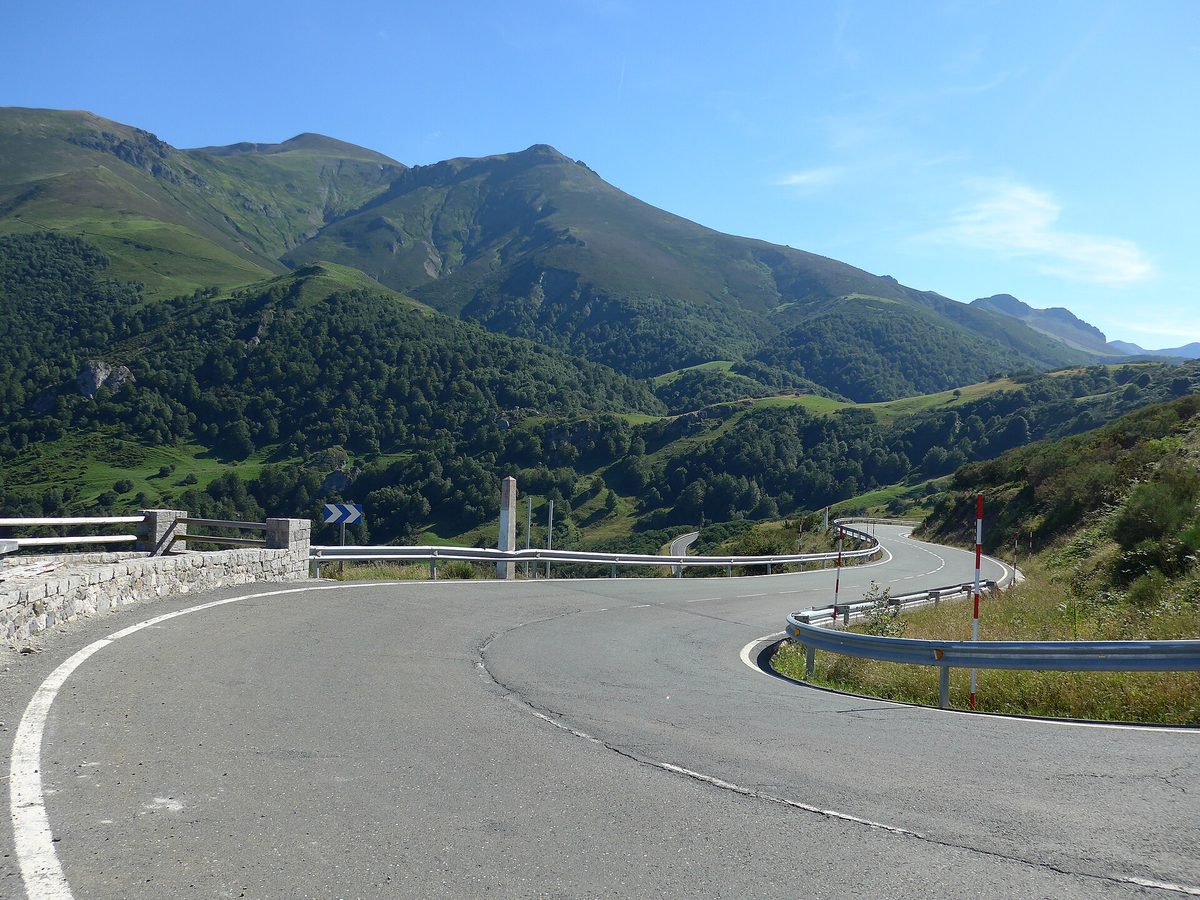

Limestone peaks rising straight out of green valleys, threaded by two deep gorge roads and two high passes.
Open: all year at low level; San Glorio (1,609 m) and Pontón (1,280 m) can have winter snow
| Vehicle | May drive it | Fuel | Tolls & ferries | Total |
|---|---|---|---|---|
| Carpetrol | YesThe road up to the Covadonga lakes is closed to private cars on set dates (bus instead). | €2715 l | none | €27 |
| Car + caravanpetrol, 12 m together | PartlyNot up to the Covadonga lakes (CO-4); the loop itself is fine. | €4023 l | none | €40 |
| Motorhomediesel, 7 m, 3.5 t | PartlyMotorhomes and anything over 5 m may not drive up to the Covadonga lakes (Turismo Asturias); the loop itself is fine. | €4926 l | none | €49 |
| Motorcyclepetrol | Yes | €1710 l | none | €17 |
The rules, with sources (2)
- Road CO-4 Covadonga – Lakes (Enol/Ercina) closed to private vehicles 24 h on 2026 dates: 28–31 Mar; 1–12, 18–19, 25–30 Apr; 1 May and May weekends; 1 Jun – 18 Oct; 24–25 and 31 Oct; 1–2 Nov; 1–8 Dec. Access by park bus only (6 Jun on foot only). Disability-badge holders may drive up. Bicycles not affected. turismoasturias.es
- Motorhomes and any vehicle over 5 m may not use CO-4 to the lakes (stated for the regulated periods). turismoasturias.es
Riders: moto-guide.com · wildroadsmotorcycletours.co.uk put it on their lists.
19. German Alpine Road (Deutsche Alpenstraße)
Germany · Lindau (Bodensee) to Schönau am Königssee · 495 km as we route it · 5–7 days · deutsche-alpenstrasse.de
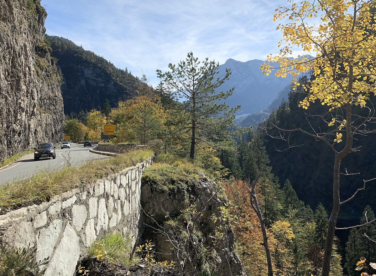

Germany's oldest holiday route, tracing the Bavarian Alps' edge from Lake Constance past Neuschwanstein and the lakes to the Königssee.
Open: all year (signposted both ways; mountain sections can need winter tyres/chains)
| Vehicle | May drive it | Fuel | Tolls & ferries | Total |
|---|---|---|---|---|
| Carpetrol | Yes | €7535 l | none | €75 |
| Car + caravanpetrol, 12 m together | Yes | €11252 l | none | €112 |
| Motorhomediesel, 7 m, 3.5 t | Yes | €13659 l | none | €136 |
| Motorcyclepetrol | PartlyKesselberg uphill closed to motorcycles 15:00–22:00 and Sudelfeld (one way) 11:00–21:00, 1 Apr–31 Oct (district orders). | €4822 l | none | €48 |
The rules, with sources (5)
- Whole route is toll-free and suitable for all vehicles including motorhomes and car + caravan (official route info). deutsche-alpenstrasse.de
- Kesselberg (Kochel → Walchensee, uphill southbound): closed to motorcycles every day 15:00–22:00 from 1 Apr to 31 Oct (Landratsamt Bad Tölz-Wolfratshausen order, made permanent Jan 2025). deutsche-alpenstrasse.de
- Sudelfeld (B307 Tatzlwurm → Bayrischzell direction only): closed to motorcycles daily 11:00–21:00, 1 Apr – 31 Oct 2026; mopeds exempt; detour via Brannenburg–Bad Feilnbach–Fischbachau. deutsche-alpenstrasse.de
- 2026 works: B307 Schliersee–Bayrischzell fully closed 17 Aug – 9 Oct 2026; B305 Inzell–Weißbach (Weinkaser) closed for avalanche-gallery works until about Oct 2026 — check before travel. deutsche-alpenstrasse.de
- Roßfeld Panoramastraße (optional side loop at Berchtesgaden): no overnight stays in vehicles or camping on the road or its car parks. rossfeldpanoramastrasse.de
Riders: deutsche-alpenstrasse.de · deutsche-alpenstrasse.de put it on their lists.
20. Lake District passes loop (Wrynose & Hardknott)
United Kingdom · a loop from Windermere · 102 km as we route it · 1 day · lakedistrict.gov.uk
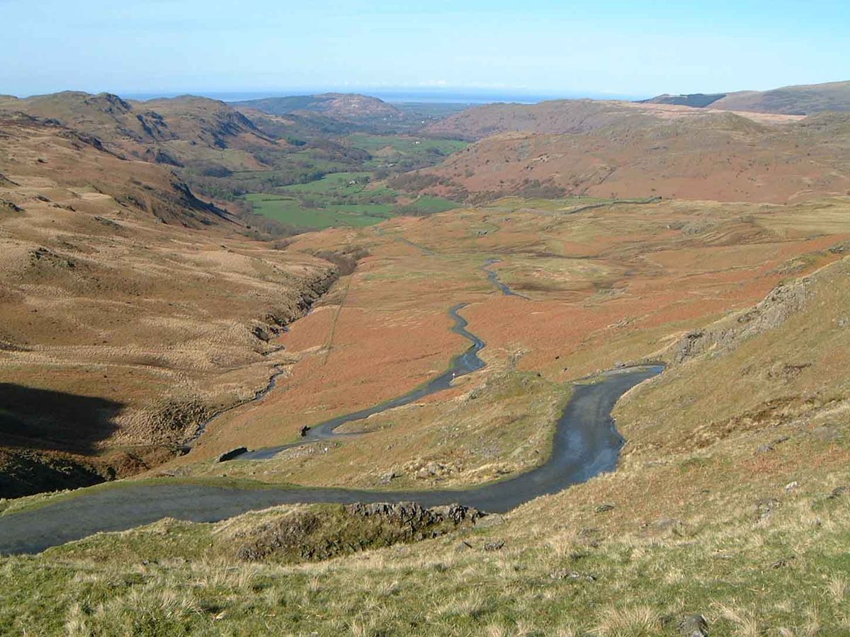

England's steepest road pair: two single-track passes with 1-in-3 hairpins between the central lakes and Eskdale's Roman fort.
Open: all year, but the passes are closed by the council when icy/snowy (winter maintenance Oct–Apr; e.g. Hardknott closed both ways for ice Jan 2025 — secondary). No fixed seasonal closure.
| Vehicle | May drive it | Fuel | Tolls & ferries | Total |
|---|---|---|---|---|
| Carpetrol | YesSingle-track with 1-in-3 hairpins; closed in ice and snow. | €157 l | none | €15 |
| Car + caravanpetrol, 12 m together | NoHardknott is signed unsuitable for caravans (press and local guides) and the National Park warns caravans have got stuck. | — | — | not allowed |
| Motorhomediesel, 7 m, 3.5 t | PartlyLarge motorhomes strongly discouraged on Hardknott and Wrynose (secondary sources). | €2912 l | none | €29 |
| Motorcyclepetrol | Yes | €95 l | none | €9 |
The rules, with sources (4)
- Lake District National Park: Hardknott, Wrynose and Honister are among the steepest roads in the country; caravans and lorries have got stuck on tight corners and narrow lanes — check gradient and width before going, don't trust sat nav. lakedistrict.gov.uk
- Road signs on Hardknott: 1-in-3 (33 %) gradient, 'Unsuitable for caravans' — secondary (BBC Travel, local guides; council sign schedule not found). bbc.com
- Single-track with hairpins up to 33 %; large motorhomes strongly discouraged — secondary. bbc.com
- Winter: fell passes closed by Cumberland Council in ice/snow (e.g. Hardknott closed both ways between Wrynose and Brook House Inn, Jan 2025) — secondary report; council winter-maintenance period October–April. cumbriacrack.com
Riders: bennetts.co.uk · visordown.com put it on their lists.