 Carsten Steger · CC BY-SA 4.0
to Brittany
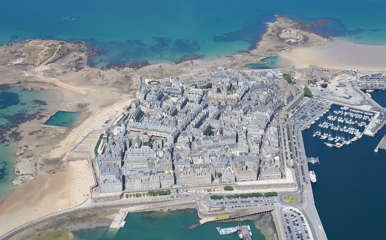
Walled port, granite coast and crêpes
7 days · 924 km · with a caravan, two people
Real routes and published prices — no guesses
- Fuel€20688 litres at an average €2.35 a litre
- Price per litre on the wayFrance €2.36 · United Kingdom €2.36
- Newhaven–Dieppe ferryprice on booking
- 6 nights€128≈ €21 a night — every night is listed under “Where you'll sleep”
- Food€278≈ €40 a day for 7 days, cheap eats
Fuel: the EU Weekly Oil Bulletin, week of 2026-10-04. Tolls, vignettes and ferries: the operators' and authorities' published prices. Nights and food: typical prices in each country for the kind chosen.
- Newhaven–Dieppe ferryprice on bookingDFDS · about 4 h on board · The operator's prices
Only official sellers are linked.
- Night 1 · Bedworth€21Griff Caravan Site · motorhome stop
- Night 2 · Billingshurst · 23 km from Crawley€21Limeburners Campsite · campsite
- Night 3 · Shoreham-by-Sea€21Withy Patch Caravan Park · motorhome stop
- Night 4 · Peacehaven€21Stud Farm Campsite · campsite
- Night 5 · Saint-Malo€22Camping de la Cité d'Alet · campsite
- Night 6 · Saint-Malo€22Camping de la Cité d'Alet · campsite
Priced for campsites: typical prices in each country, not a booking.
Sources: EU weekly fuel bulletin · operators' published tariffs · Wikipedia · map © OpenStreetMap contributors
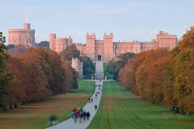
- Windsor CastleWindsor Castle is a royal residence at Windsor in the English county of Berkshire, about 25 miles west of central London.305 km
Windsor Castle
Day 2 · 47 km before tonight's stop
During the First World War, the historic estate inspired the naming of the royal House of Windsor.
Wikipedia · Diliff · CC BY 2.5
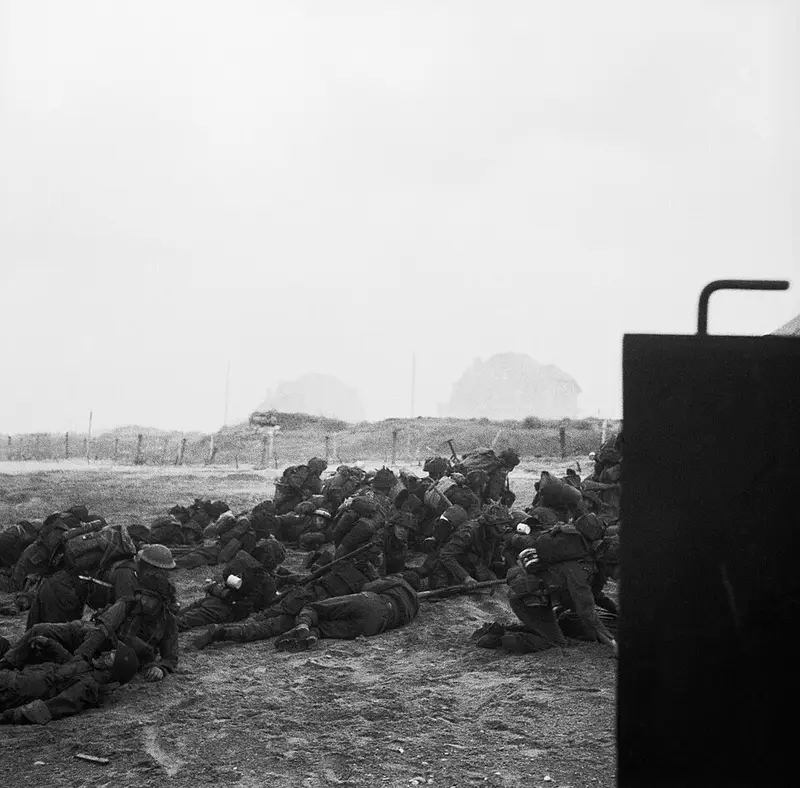
- Sword BeachSword, commonly known as Sword Beach, was the code name given to one of the five main landing areas along the Normandy coast during the initial assault phase, Operation Neptune, of Operation Overlord.724 km
Sword Beach
Day 5 · 309 km into the day · a lunch stop
Sword, commonly known as Sword Beach, was the code name given to one of the five main landing areas along the Normandy coast during the initial assault phase, Operation Neptune, of Operation Overlord.
Wikipedia · Mapham, Jim (Photographer), No. 5 Army Film and Photo Section, Army Film and Pho · Public domain
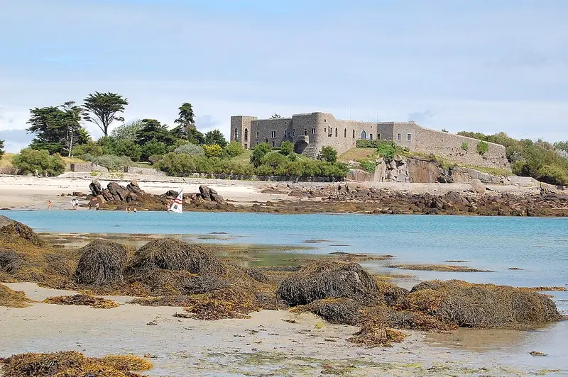
- ChauseyChausey is a group of small islands, islets and rocks off the coast of Normandy, in the English Channel.30 km
Chausey
Day 6 · 30 km from Saint-Malo
Chausey is a group of small islands, islets and rocks off the coast of Normandy, in the English Channel.
Wikipedia · Pline · CC BY-SA 3.0
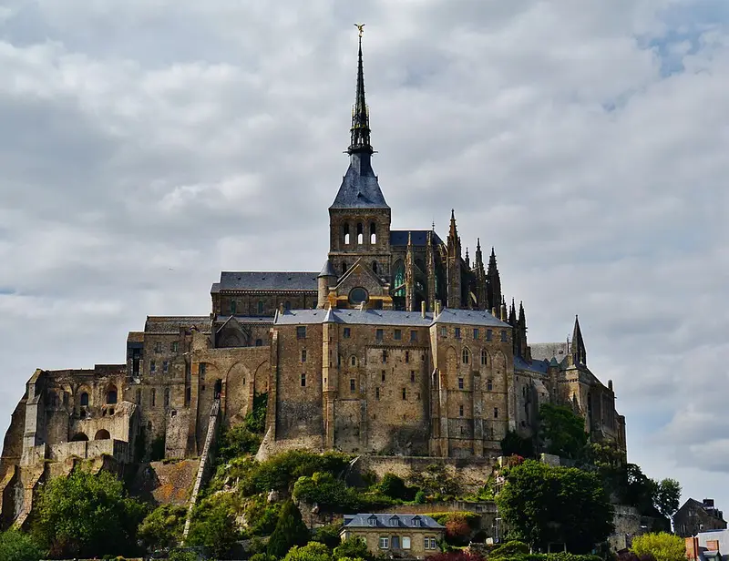
- Mont-Saint-Michel AbbeyThe Mont-Saint-Michel Abbey is an abbey located within the city and island of Mont-Saint-Michel in Normandy, in the department of Manche.38 km
Mont-Saint-Michel Abbey
Day 6 · 38 km from Saint-Malo
The Mont-Saint-Michel Abbey is an abbey located within the city and island of Mont-Saint-Michel in Normandy, in the department of Manche.
Wikipedia · Zairon · CC BY-SA 4.0
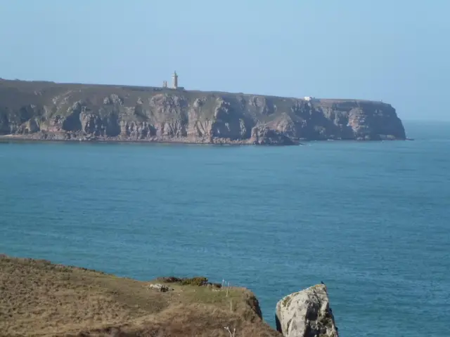
- Cap FréhelCap Fréhel is a peninsula in Côtes-d'Armor, in northern Brittany, France which extends off the Côte d'Émeraude into the Bay of Saint-Malo.22 km
Cap Fréhel
Day 6 · 22 km from Saint-Malo
Cap Fréhel is a peninsula in Côtes-d'Armor, in northern Brittany, France which extends off the Côte d'Émeraude into the Bay of Saint-Malo.
Wikipedia · Nortmannus · CC BY-SA 3.0