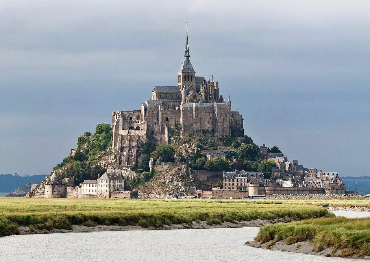
 Diliff · Public domain
to Normandy
D-Day beaches, the Tapestry and Mont-Saint-Michel
6 days · 551 km · by car, two people
Real routes and published prices — no guesses
- Fuel€6833 litres at an average €2.06 a litre
- Price per litre on the wayUnited Kingdom €2.07 · France €2.21
- Motorway tolls in France€4.71A13
- Motorway tolls in France≈ €19An allowance: 215 tolled km at the country's usual rate — we don't hold its published tariff yet.
- Dover–Calais ferryprice on booking
- Dartford Crossing€4.13Car
- London Congestion Charge€21.25Car · 1 day
- 5 nights€390≈ €78 a night — every night is listed under “Where you'll sleep”
- Food€242≈ €40 a day for 6 days, cheap eats
Fuel: the EU Weekly Oil Bulletin, week of 2026-10-04. Tolls, vignettes and ferries: the operators' and authorities' published prices. Nights and food: typical prices in each country for the kind chosen.
- Dover–Calais ferryprice on bookingDFDS / P&O Ferries / Irish Ferries · about 1.5 h on board · The operator's prices
- Motorway tolls in France€4.71Paid on the road: A13
- Motorway tolls in France≈ €19An allowance: 215 tolled km at the country's usual rate — we don't hold its published tariff yet.
- Dartford Crossing€4.13
- London Congestion Charge€21.25
- Low-emission zoneLondon: ULEZ — £12.50/day if non-compliant (covers all Greater London)
Only official sellers are linked.
- Night 1 · Saint-Martin-Boulogne€78Formule 1 · hotel
- Night 2 · Belmesnil · 37 km from Rouen€78Clos masure · hotel
- Night 3 · Honfleur · 69 km from Bayeux€78Ferme de la grande cour · hotel
- Night 4 · Honfleur · 69 km from Bayeux€78Ferme de la grande cour · hotel
- Night 5 · Honfleur · 69 km from Bayeux€78Ferme de la grande cour · hotel
Priced for budget hotels: typical prices in each country, not a booking.
Sources: EU weekly fuel bulletin · operators' published tariffs · Wikipedia · map © OpenStreetMap contributors
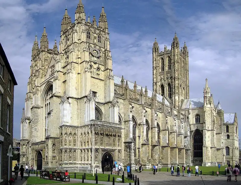
- Canterbury CathedralCanterbury Cathedral is the cathedral of the archbishop of Canterbury, the spiritual leader of the Church of England and symbolic leader of the worldwide Anglican Communion.97 km
Canterbury Cathedral
Day 1 · 97 km into the day · a lunch stop
Located in Canterbury, Kent, it is on the site of one of the oldest Christian structures in England and forms part of a World Heritage Site.
Wikipedia · Hans Musil · CC BY-SA 4.0
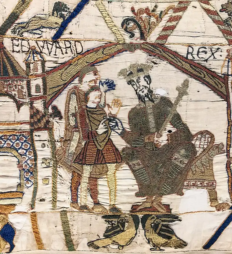
- Bayeux TapestryLa tapisserie de Bayeux ou broderie de Bayeux, successivement désignée « Telle du Conquest » par les chanoines de la cathédrale Notre-Dame de Bayeux, toilette de la Saint-Jean et toilette du duc Guillaume au XVIIIe siècle, ou encore tapisserie de la reine Mathilde au XIXe siècle, est une broderie du XIe siècle inscrite depuis 2007 au registre international Mémoire du monde par l'Unesco.1 km
Bayeux Tapestry
Day 4 · in Bayeux
La tapisserie de Bayeux ou broderie de Bayeux, successivement désignée « Telle du Conquest » par les chanoines de la cathédrale Notre-Dame de Bayeux, toilette de la Saint-Jean et toilette du duc Guillaume au XVIIIe siècle, ou encore tapisserie de la reine Mathilde au XIXe siècle, est une broderie du XIe siècle inscrite depuis 2007 au registre international Mémoire du monde par l'Unesco.
Wikipedia · Myrabella · Public domain
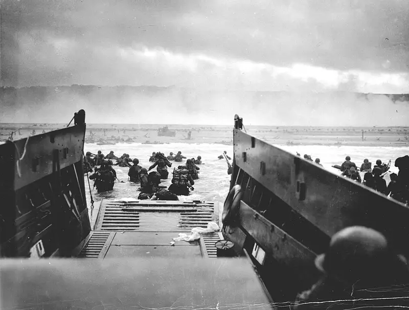
- Omaha BeachOmaha Beach was one of five Allied beach landing sectors of the amphibious assault component of Operation Overlord during the Second World War.16 km
Omaha Beach
Day 4 · 16 km from Bayeux
Omaha Beach was one of five Allied beach landing sectors of the amphibious assault component of Operation Overlord during the Second World War.
Wikipedia · Chief Photographer's Mate (CPHOM) Robert F. Sargent, U.S. Coast Guard · Public domain
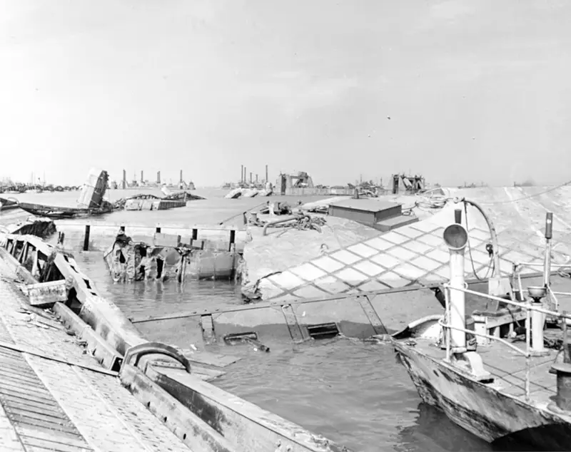
- Mulberry harbourLe port Mulberry est un port préfabriqué construit en Angleterre puis assemblé sur la côte normande pendant la Seconde Guerre mondiale pour permettre l'approvisionnement des Alliés dans les jours qui suivirent le débarquement de Normandie.10 km
Mulberry harbour
Day 4 · 10 km from Bayeux
Le port Mulberry est un port préfabriqué construit en Angleterre puis assemblé sur la côte normande pendant la Seconde Guerre mondiale pour permettre l'approvisionnement des Alliés dans les jours qui suivirent le débarquement de Normandie.
Wikipedia · Post-Work: User:W.wolny · Public domain